
Garmin GPS 73
4.4Editor score
SAILASSIST sailing features included
18 hours battery life
MOB and marine alarms
Navigating the open water requires precision and reliability to ensure safety on every journey. A handheld GPS for boating provides essential tools for mariners to track their position and avoid hazards effectively.
We evaluated ten leading models based on durability, satellite accuracy, battery life, and marine-specific features. Our analysis focuses on devices that offer robust performance in challenging aquatic environments for serious boaters.
Each pick highlights unique strengths to help you choose the right unit for your vessel. Prices and availability fluctuate often so verify current details before making your final purchase decision.
4.4Editor score

4.0Editor score
4.2Editor score
As an Amazon Associate we earn from qualifying purchases.
This side-by-side comparison highlights the key specifications of all ten models to help you decide which device fits your specific boating needs and budget requirements.



The Garmin GPSMAP 79sc is a top contender for serious mariners needing reliable navigation. With a 4.0 rating, it stands out for its preloaded coastal charts and rugged build quality that handles water exposure.
We may earn a commission when you buy through this link, at no additional cost to you.
Its BlueChart g3 coverage provides essential depth and hazard data right out of the box. The floating design ensures it won't sink if dropped, while the IPX6 rating protects against rain and splashes.
Battery life reaches 20 hours in GPS mode which supports long trips without recharge. The tilt-compensated compass adds safety when stationary by showing heading without movement required.
Boaters prioritizing chart detail and durability should choose this unit. It balances high-end features with practical marine needs effectively for most vessel owners.
Preloaded charts reduce setup time and ensure you have critical depth info immediately.
Floats on water and resists drops making it ideal for active deck environments.
We may earn a commission when you buy through this link, at no additional cost to you.
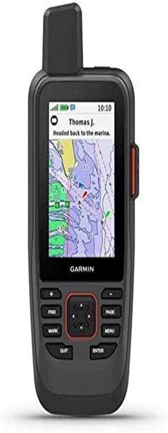
The Garmin GPSMAP 86Sci leads premium handhelds with satellite communication capabilities. Rated 4.2, it offers peace of mind via Iridium network connectivity for emergency SOS and text messaging.
We may earn a commission when you buy through this link, at no additional cost to you.
It consolidates marine info by streaming data from compatible chartplotters to your handheld. This integration simplifies navigation by keeping instrument data accessible without moving to the helm station.
The subscription cost adds to long-term expense but enables critical safety features globally. Boat owners offshore or remote waters will value the independent communication link.
Investors seeking top-tier safety and connectivity should prioritize this model. It justifies its price with unique satellite integration unmatched by standard navigators.
Stay connected globally via Iridium even without cellular coverage during offshore trips.
Stream data to handhelds for easier monitoring while moving around the vessel.
We may earn a commission when you buy through this link, at no additional cost to you.
The Garmin GPS 73 is an affordable option optimized for sailing needs. With a strong 4.4 rating, it offers essential features like virtual starting lines and tack assist at a low cost.
We may earn a commission when you buy through this link, at no additional cost to you.
Its user interface uses dedicated backlit buttons for quick operation in various light. Marine alarms for off-course or anchor drag provide necessary alerts without complex menus.
Running on 2 AA batteries it delivers over 18 hours of runtime. This longevity is perfect for weekend trips where charging options are limited.
Budget conscious sailors will find this unit ideal for basic navigation. It delivers core marine functions reliably without expensive advanced mapping costs.
Features like speed history and tack assist tailor navigation for sailboat use.
Physical buttons ensure control even with wet gloves or in rough weather.
We may earn a commission when you buy through this link, at no additional cost to you.
The Garmin GPSMAP 79s offers global coverage for international boaters. Rated 4.2, it includes a worldwide basemap ensuring basic navigation anywhere you travel.
We may earn a commission when you buy through this link, at no additional cost to you.
It shares the rugged floating design of the 79sc but focuses on general tracking. The high-resolution display remains clear in bright sun for quick position checks.
Battery life hits 20 hours ensuring reliability on extended voyages. The barometric altimeter adds altitude precision useful if traversing varied coastal terrain.
Travelers needing global navigation without specific chart costs should consider this. It balances portability with essential tracking for international waters.
Worldwide basemap ensures you can track position regardless of region.
Floats on water and resists drops making it ideal for active deck environments.
We may earn a commission when you buy through this link, at no additional cost to you.
The Garmin eTrex SE excels in battery endurance for remote boaters. With a 4.2 rating, it offers up to 168 hours in standard mode using field-replaceable AA batteries.
We may earn a commission when you buy through this link, at no additional cost to you.
Its IPX7 rating ensures protection against immersion for longer periods than typical marine devices. The digital compass provides accurate heading even when stationary on the water.
Pairing with the Explore app enables software updates and Active Weather data. This connectivity helps adapt to changing conditions without physical map swaps.
Boaters needing extreme battery life and basic navigation should choose this. It suits those prioritizing reliability over detailed charting capabilities.
168 hours runtime supports multi-day trips without needing charging access.
IPX7 rating ensures protection against immersion for longer periods.
We may earn a commission when you buy through this link, at no additional cost to you.
The Garmin GPSMAP 65 uses multi-band technology for superior accuracy. With a 4.5 rating, it excels in challenging environments where standard signals struggle to reach clearly.
We may earn a commission when you buy through this link, at no additional cost to you.
Its 2.6 inch sunlight-readable display ensures visibility on bright open water. Button operation remains intuitive allowing quick inputs even with wet or gloved hands.
Mapping includes federal public land maps plus TopoActive data for broader routes. While marine-specific features are fewer, GPS precision remains top-tier.
Precision seekers needing high accuracy should prioritize this model. It handles complex terrain and open water navigation effectively.
Multi-band technology delivers optimal accuracy in challenging locations.
Screen visibility remains high even under direct sunlight conditions.
We may earn a commission when you buy through this link, at no additional cost to you.
The Garmin GPSMAP 79sc Renewed offers top features at a lower cost. With a high 4.8 rating, this certified renewed unit retains the core marine navigation capabilities of the original.
We may earn a commission when you buy through this link, at no additional cost to you.
It includes preloaded BlueChart g3 coastal charts for detailed marine mapping. The floating design and IPX6 rating remain intact ensuring durability on water.
Budget buyers benefit from significant savings while getting essential marine tools. The renewed process ensures functionality matches new units closely.
Those prioritizing value over pristine packaging should choose this. It delivers premium features without the full price tag.
Certified renewed units offer full functionality at lower costs for buyers.
Includes charts and floating design maintaining the full capability of new models.
We may earn a commission when you buy through this link, at no additional cost to you.
The Garmin eTrex 32x is a rugged navigator with advanced specs. Rated 4.2, it features a 3-axis compass and barometric altimeter for enhanced positional accuracy.
We may earn a commission when you buy through this link, at no additional cost to you.
With 8 GB internal memory plus a micro SD slot you can load extra maps. This flexibility supports diverse navigation needs beyond standard preloaded data.
Battery life reaches 25 hours with AA batteries supporting long trips. The display remains readable in sun ensuring visibility during bright days.
Boaters needing rugged durability and map expansion should consider this. It serves well for users requiring customizable navigation data.
Micro SD card slot allows for map downloads beyond standard memory.
Built to withstand tough environments ensuring reliability in rough conditions.
We may earn a commission when you buy through this link, at no additional cost to you.
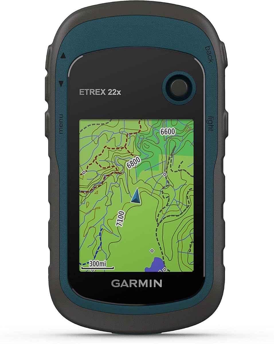
The Garmin eTrex 22x offers reliable navigation for general use. Rated 4.3, it features preloaded Topo Active maps for detailed terrain tracking during excursions.
We may earn a commission when you buy through this link, at no additional cost to you.
Its 2.2 inch sunlight-readable display ensures clear views in bright conditions. Battery life supports up to 25 hours with standard AA power.
While it lacks specialized marine charts it provides solid tracking and storage. Compact size makes it easy to carry on smaller vessels.
Budget boaters needing a backup navigator will find this useful. It balances performance and portability effectively for most needs.
Preloaded Topo Active maps provide detailed terrain tracking data for excursions.
Small design makes it easy to carry on smaller vessels.
We may earn a commission when you buy through this link, at no additional cost to you.
The Garmin GPS 76 is a classic navigator for basic positioning. With a 4.6 rating, it offers WAAS enabled GPS tracking for higher accuracy than standard units.
We may earn a commission when you buy through this link, at no additional cost to you.
Its trip computer displays current speed, timer, and distance useful for pacing. While older it provides reliable tracking without complex features to manage.
Battery life reaches 16 hours on 2 AA alkaline batteries. Compact form factor fits easily in pockets or small storage spaces.
Those seeking simple and proven tracking should choose this. It delivers essential data without advanced connectivity demands.
WAAS enabled GPS tracking provides higher accuracy than standard units.
Provides reliable tracking without complex features to manage.
We may earn a commission when you buy through this link, at no additional cost to you.
Selecting the right GPS requires analyzing durability, accuracy, and marine features.
A handheld GPS for boating must withstand water exposure. Look for units with IPX6 or IPX7 ratings to ensure protection from rain and splashes.
Prioritize higher IP ratings for better protection against immersion and rough weather.
Floating capabilities prevent losing your device if dropped into the water. Many marine units include buoyant casings to aid quick retrieval.
Choose floating models to minimize replacement costs after accidental drops.
Preloaded coastal charts like BlueChart g3 save setup time. Ensure the unit includes relevant maps for your local waters.
Verify chart coverage matches your boating region to avoid missing data.
Long battery life supports extended trips without charging. Look for 18+ hours on AA batteries or rechargeable options.
Opt for long endurance to maintain navigation during multi-day journeys.
Multi-GNSS support ensures accurate positioning globally. Devices supporting GPS, GLONASS, or Galileo work better in challenging areas.
Check satellite constellations for reliable tracking in your specific region.
Button-operated interfaces work better than touchscreens in wet conditions. Physical buttons allow quick access even with gloves.
Prioritize physical buttons for reliable control in wet weather.
Marine alarms and SOS capabilities add security. MOB and anchor drag alerts prevent drift or danger.
Ensure critical safety alarms are included for emergency preparedness.
Prices vary widely between basic and premium models. Balance essential features with your specific navigation needs.
Set a budget that covers core marine features without unnecessary extras.
Always charge or insert fresh batteries before heading out to ensure full runtime. Verify the antenna has a clear view of the sky for accurate satellite lock.
Rinse the device with fresh water after exposure to saltwater to prevent corrosion. Keep the lens clean and dry to maintain visibility in sunlight.
Store the GPS in a waterproof dry bag when not in use to avoid accidental drops or moisture ingress. Regularly check for firmware updates to maintain performance.
Yes, handheld GPS units offer better water resistance and battery life than phones. They are designed to float and withstand harsh marine environments without damage.
Basic navigation does not require a subscription. However, real-time weather or satellite messaging like Inreach needs a plan for full functionality.
Most models provide 18 to 25 hours of runtime on standard AA batteries. This ensures coverage for most full-day boating trips without recharging.
Yes, models with worldwide basemaps work globally. Ensure satellite support matches your region for accurate tracking.
Look for at least IPX6 rating to resist rain and splashes. IPX7 offers better protection against accidental immersion.
Advanced models can stream data from chartplotters. Check connectivity options if you want to share instrument data.
Use a microSD card or USB connection to download new charts. Some units support wireless updates via companion apps.
Many include MOB alerts or SOS communication. Premium models offer two-way messaging via satellite for remote areas.
The Garmin GPSMAP 79sc and 86Sci stand out for detailed charts and satellite safety. The GPS 73 offers a budget-friendly option for essential navigation features.
Prioritize durability and water resistance to protect your investment. Battery life and clear display visibility are also critical for long trips.
Verify current prices and availability as these fluctuate frequently. Always check local warranty and support before making your final purchase.